Models & specificitiesDescriptiveReviewsA questionBesoin de formation
Models & specificities
Back to menu
Reference
Price inc VAT
Price inc VAT
010-C1275-20
£212.50
£212.50
Models & specificitiesDescriptiveReviewsA questionBesoin de formation
Descriptive
Back to menu
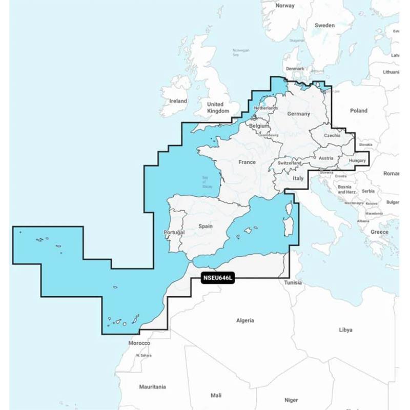
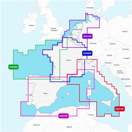
GARMIN NAVIONICS+ Map of Central and Western Europe with high definition bathymetry
Detailed coverage of Central and Western Europe. Coverage includes the European coast, from the Szczecin Lagoon to Monaco; the Azores; Madeira; the Canary Islands; the Balearics; Corsica and Sardinia; Gibraltar, the Channel; the Channel Islands; the Ijsselmeer; the rivers of France, Germany and Benelux; Lake Maggiore, Lake Como, Lake Garda, Lake Geneva, Lake Constance and Lake Balaton.
ALL-IN-ONE MAPPING SOLUTION FOR GARMIN PLOTTERS UNLIMITED MAP UPDATES AUTOGUIDING+ TECHNOLOGY DEPTH SHADING BATHYMETRIC CURVES UP TO 0.5 M SHOAL SHADING ACTIVECAPTAIN COMMUNITY Compatibility with ECHOMAP UHD 7/9, UHD² 5/7 and ULTRA10/12 GPS Fishfinders
The Map is in MICRO-SD format delivered on an SD support to be compatible with different card readers.