Models & specificitiesDescriptiveReviewsA questionBesoin de formation
Models & specificities
Back to menu
Reference
Price inc VAT
Price inc VAT
010-C1261-00
£212.50
£212.50
Models & specificitiesDescriptiveReviewsA questionBesoin de formation
Descriptive
Back to menu
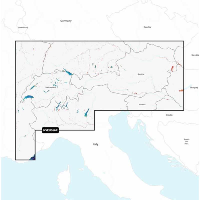
GARMIN NAVIONICS VISION+ Card Inland Alps, Lakes and rivers with high definition bathymetry
Advantages of the VISION+ range
RELIEF SHADING 2 HIGH RESOLUTION SATELLITE IMAGES 2 AERIAL PHOTOGRAPHY FISHEYE 3D VIEW MARINEREYE 3D VIEW
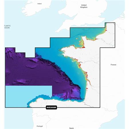
The lakes and rivers in the Alpine region are covered. The coastal coverage includes Lake Constance (Untersee, Obersee and Seerhein), Zurich, Lucerne, Geneva, Thun, Brienz, Annecy, Le Bourget, lake of Aiguebelette, the lake of Sainte-Croix, Neuchâtel, Maggiore, Orta San Giulio, Como, Iseo, Lugano, Garda, Biel and Neusiedl/Ferto. Among the rivers are the Rhine from its source to Germersheim, the Danube from its source to Bratislava, the Neckar from its source to Offenau and the Rhine-Main-Danube canal from Hilpoltstein to Danube. Additional water bodies include the Isar, Inn, Salzach and Lech along their entire length.
ALL-IN-ONE CARTOGRAPHIC SOLUTION FOR GARMIN PLOTTERS UNLIMITED MAP UPDATES AUTOGUIDING+ TECHNOLOGY DEPTH SHADING BATHYMETRIC CURVES UP TO 0.5 M SHALLOW WATER SHADING ACTIVECAPTAIN COMMUNITY Compatibility with ECHOMAP UHD 7/9 series GPS Sounders, UHD² 5/7 and ULTRA10/12
The Card is in MICRO-SD format delivered on an SD support to be compatible with different card readers.