Models & specificitiesDescriptiveReviewsA questionBesoin de formation
Models & specificities
Back to menu
Reference
Price inc VAT
Price inc VAT
010-C1261-20
£136
£136
Models & specificitiesDescriptiveReviewsA questionBesoin de formation
Descriptive
Back to menu
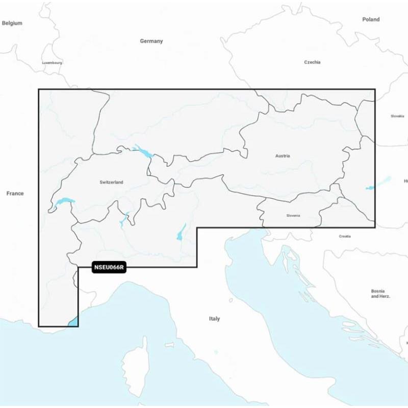
GARMIN NAVIONICS+ Interior Alps, Lakes and Rivers Map with High-definition Bathymetry
The lakes and rivers of the Alps region are covered. Coast coverage includes Lake Constance (Untersee, Obersee and Seerhein), Zurich, Lucerne, Geneva, Thun, Brienz, Annecy, Le Bourget, Aiguebelette, Lake Sainte-Croix, Neuchâtel, Maggiore, Orta San Giulio, Como, Iseo, Lugano, Garda, Biel and Neusiedl/Ferto. River coverage includes the Rhine from its source to Germersheim, the Danube from its source to Bratislava, the Neckar from its source to Offenau, and the Rhine-Main-Danube Canal from Hilpoltstein to the Danube. Other covered river segments include the Isar, Inn, Salzach and the Lech along their entire lengths.
ONE-IN-ALL MAPPING SOLUTION FOR GARMIN PLOTTERS UNLIMITED MAP UPDATES AUTOGUIDING+ TECHNOLOGY DEPTH SHADING CONTOUR LINES UP TO 0.5 M SHALLOW WATER SHADING ACTIVECAPTAIN COMMUNITY Compatible with ECHOMAP UHD 7/9, UHD² 5/7 and ULTRA10/12 series of GPS Sounders
The Map is supplied in MICRO-SD format on an SD holder, making it compatible with a variety of card readers.